Popular Topics
Choose
Popular Links
Google Earth
updated by rck, 2005-06-30

Google Maps is a huge success. And a nice example for another successful Google application. Too bad that there are only maps about US and UK.
Google Earth is the next cartography attempt of Google. And it's even more successful. It is apparently so successfull that Google even had to temporarily disable the download of it. Download? Yes, it's a windows program, based on Direct X.
What's in?
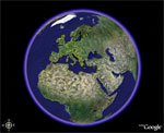
So what can Google Earth do? It shows the earth. In 3D. You can rotate it, tilt it (change the viewing angle), move it around and zoom in.
Zooming in is where the fun begins. You can enrich your display by various informations. Stuff included:
- Roads
- Borders
- Terrain
- Buildings
- etc.
And the application is fast. I'm running it on my trusted Athlon 1.2 GHz with 1 GB RAM. Google Earth seems to be using about 120 MB of it. And it does quite some swapping on my C drive. Still, it is very responsive.
Downsides?
Is there room for improvement? Are there any downsides? Well, yes, there certainly is. The resulution you can zoom down to isn't exactly great. Have a look at the image to the left. This would be Korneuburg's power plant. And compare it to these pictures. The four circles on Google Earth are the silos, that other thing is the plant itself. I captioned them for clarity.
If I wouldn't know the real thing (location: 48°19'53.14" N, 16°20'20.83" E, elev 546ft) I wouldn't know it from the Map.
Another thing I don't quite uinderstand: Why does Google Earth always start at America? My IP address should be obvious to Google Earth so it should be able to find my location, too. And that would be the perfect starting point, wouldn't it? At least some where in Europe.
| The comments are owned by the poster. We are not responsible for its content. |

What's Related
Article Manager
Webtechnologien
- Keine neuen Cliés mehr
- Showing current colordepth & screensize
- Improvability
- kiesler.at auf verschiedensten Browsern
- Easing GoogleBots life
- Google defends Bombing
- Pagerank 5
- Order me
- Google ist sechs Jahre alt!
- Google ermöglicht grafische Werbung
- Google Suchergebnisse
Link Manager
Webtechnologien
- Facebook Application Development
- PluginDoc: Firefox Memory Usage FQA
- Matt Cutts: Gadgets, Google, and SEO » Make a...
- HostTracker [Website Monitoring Service] | Home
- SiteUptime - Free Website Monitoring Service
- Performance Analysis of the Apache Web Server
- InternetSupervision.com - Url Check
- The Webcredibles - here to save your website!
- SiteReportCard: Web Site Optimization and Pro...
- A free under construction graphics site. Lots...
- 10Bet Referrer-Code
- Track Google AdSense Clicks via Google Analytics
- Google Cluster Architecture
- Site Check
- Spam Google
- Google Talk
- Google Review on Search Engine Showdown
- Google Sightseeing
- Google Community
- Xtra Google
Google Suggests
Wiki
Webtechnologien
- YahooPipesRegex
- YahooPipes
- WEAssignMent1
- WETopDonts
- WEQualitaetsKriterien
- WEAufgabenAbgrenzung
- WebEngineering
- AbgrenzungWebEngineering
Bulletin Board
Webtechnologien
RSS News Feeds
Webtechnologien
- Aphorismen und Zitate gegen Abmahnwelle
- CyDome
- mozillaZine
- Hicksdesign articles
- Peter Bowyer's weblog
- silverorange labs
- circle.ch weblog
- Need to Know
- Lockergnome Web Developers
- Decaf Bad
Announcements
Webtechnologien
Latest Updates
AdministrativeTexts
updated by freddiemac1993, 2013-06-14
wiki
Re: adventures
created by brittdavis10, 2012-02-23 (1 rply, 3 views)
thread
Re: how to run phpwebsite...
created by alexander, 2011-08-25 (2 rpls, 3607 views)
thread
Re: Forum tags
created by HaroldFaragher, 2011-08-22 (3 rpls, 8488 views)
thread


